
Island End River Flood Resilience Project
Island End River Flood Resilience Project
Island End River Flood Resilience Project
Island End River Flood Resilience Project
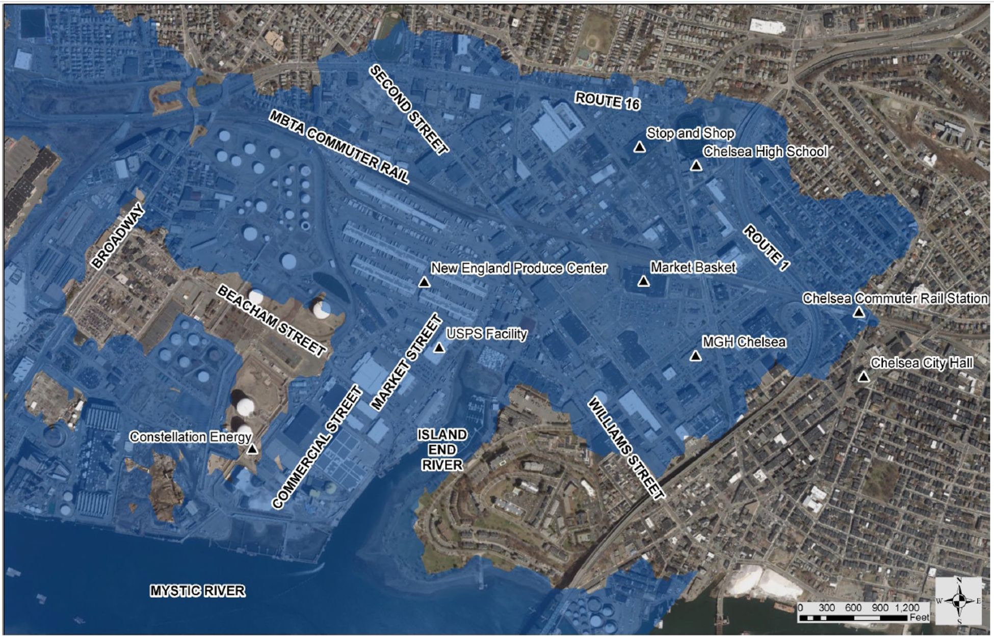
This critically vital project is a collaborative effort between the Cities of Everett and Chelsea to prevent projected coastal storm surge flooding from the Island End River across a 500-acre floodplain that will impact more than, 5,000 residents, 800+ buildings and 11,000 jobs in southeast Everett and southwest Chelsea.
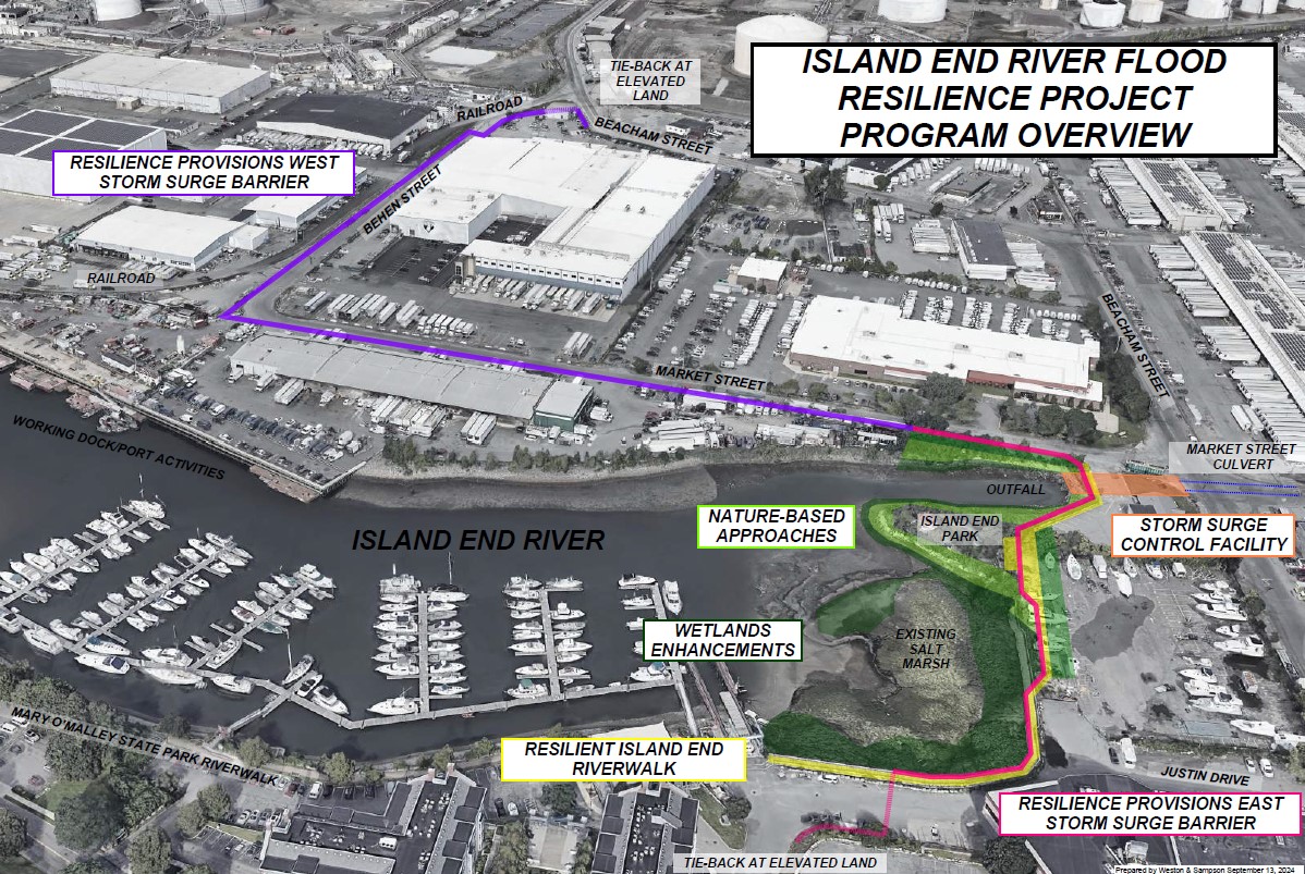
The Cities are working to construct a coastal storm surge barrier, storm surge control facility, nature-based solutions along the riverfront, and related amenities at the Island End River. The approximately 5.2-acre Project Site is currently composed of a mix of commercial and industrial uses and supporting roadway and utility infrastructure.
Without this project, every major flood would inflict more than $200 million in direct damage, adding up to $3.7 billion over 50 years–more than 30 times the cost of the project. This does not include secondary costs like $30 million in lost wages, $79 million in lost sales, and up to $570 million in health care costs from food insecurity made worse by closure of the produce center.
**JUNE 2025 FUNDING UPDATE!!**
The Island End River Flood Resilience Project (IERFRP) has seen a groundswell of support from many quarters since the announcement of cuts to FEMA's Building Resilient Infrastructure and Communities (BRIC) program, which resulted in a significant funding gap for the project. This vital project will still be built, but the loss of matching state grant money tied to the federal funds has stretched out the timeline for completion. The IERFRP Project Management Team is gratified by the strong support we have received since the announcement of the BRIC cuts. Political leaders, state and federal regulators, community groups as well as members of the public have pledged support and have taken action to help find the needed construction money for this desperately needed project. We are grateful for the outreach and support. With the approved permits and funds already in hand we will continue to move the project ahead to a "Shovel-Ready" status while continuing to find the additional funding we need for construction.
The Commonwealth of Massachusetts as well as state federal legislative leaders know this project is vitally important to the region and have committed publicly to assist in finding the monies needed to fund the IERFRP. City leaders from Chelsea and Everett have reaffirmed their commitment to this project. Community groups speak out at meetings communicating the need for and importance of this work and support in finding the funding.
The certainty of the IERFRP construction is not a matter of "if"... only of "when".
We will keep you updated!
The Risk
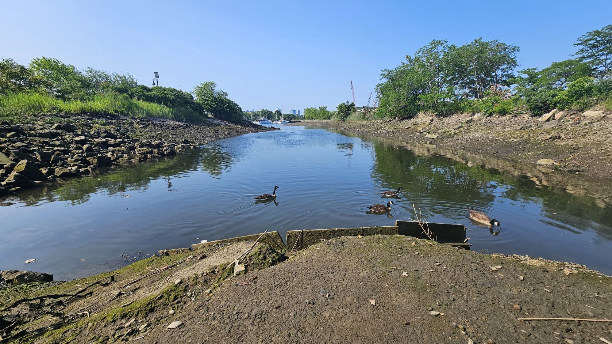
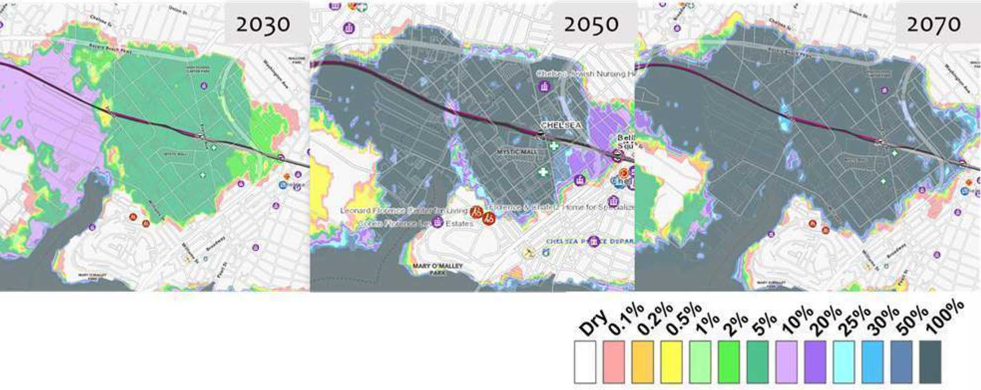
Island End River on the Everett/Chelsea border already floods often during high tide, even in calm weather. The flooding will happen with increasing frequency and severity - almost weekly by 2030 and twice per day by 2050.
A section of the low-lying area was heavily industrial, and flooding threatens the release of petrochemicals and other hazardous materials stored there.
Increased flooding threatens residences of 5,000 people in the floodplain and $7 billion in annual economic activity.
The tracks of the MBTA commuter rail serving the entire North Shore already have experienced flooding that halted service.
Hurricane Sandy-level flooding will happen frequently in the coming decades, swamping contaminated sites and cutting off highways and rails to regional commuting and shipping.
The project that has been fully permitted would create an essential barrier to protect this area, preventing an estimated $3.7 billion in damage—more than 30 times the cost of the project.
Without this project, workers and businesses would suffer $30 million in lost wages and $79 million in lost sales from every major storm.
Without the project, the region faces up to $570 million in additional regional health care costs from every major storm because of the loss of nutritious food through supply disruptions, business closures, and higher prices.


Project Funding
Federal: Approx. $750,000
State & Local: Approx. $10 million to date
On-going exploration of construction funding options.
Project Phase June 2025
The project is in the final phase of permitting. Negotiations with abutting stakeholders on easement rights on-going. Final Design and Construction Bidding Package work on-going.
Flood Resilience is a term that generally covers strategies for reducing damage to homes, businesses, and roads that is caused when a river overflows. By ensuring ample natural landscape that can handle above average river levels and by building flood barriers the local community will be more protected from damaging floods.
A flood resilient community is able to quickly recover from substantial and frequent flooding with minimal damage, disruption and cost.
The Island End River Flood Resilience Project will protect:
Food Security for millions in New England and beyond.
5,000+ Residents in Underserved Communities
Nearly 500 Acres of Land and 800+ Buildings
More than 2 Acres of Ecological Improvements
11,000+ Jobs
Want to stay informed?
Get project updates directly in your inbox.