
Island End River Flood Resilience Project
Island End River Flood Resilience Project
Island End River Flood Resilience Project
The Island End River Flood Resilience Project proposes to construct an approximately 4,460 linear-foot storm surge barrier, an approximately 3,000 square-foot underground storm surge control facility, approximately 18,000 square feet of nature-based approaches along the riverfront, and associated wetland and public access improvements along the IER in the Cities of Chelsea and Everett (the “Project Site”) to protect over 5,000 residents.
The approximately 5.2-acre Project Site is currently composed of a mix of commercial and industrial uses and supporting roadway and utility infrastructure. The existing banks of the river are highly degraded by legacy industrial uses and are comprised of hardened slope stabilization measures and littered with debris.
The Project is critical for the flood protection of the IER district and surrounding low-lying areas in Chelsea and Everett, which include the residences of under-served EJ communities, vital regional food distribution facilities, over 11,000 jobs, significant transportation (rail and roadway) infrastructure, health care facilities, a grocery store serving much of the community, and a public high school. As this district contains vital regional infrastructure facilities every effort was made to protect roadway access to seaward parcels to ensure private operator and public safety access to these facilities. These assets are all projected to be within the 100-year floodplain by 2070.
Additionally, the Project will enhance natural resource areas, improve public access to the IER, and substantially improve Island End Park.
Areas of Improvement
EVERETT- Resilience Provisions West
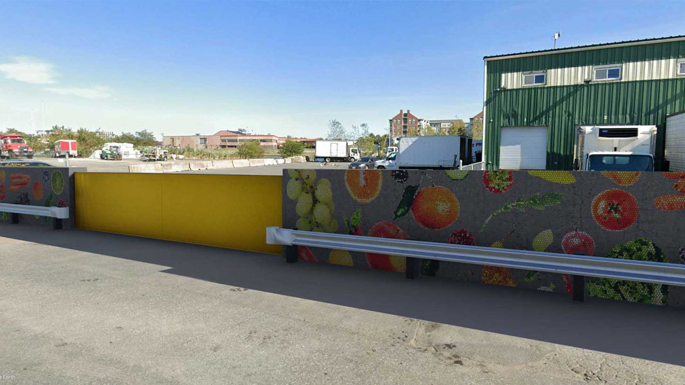
Build inland flood barrier construction within the City of Everett to protect working port businesses from coastal inundation.
CHELSEA-Resilience Provisions East
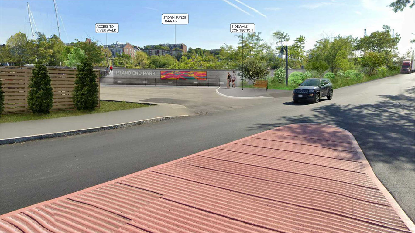
Continue coastal and inland flood barrier and improve public amenities, including improved pedestrian waterfront access and a new boardwalk within the City of Chelsea.
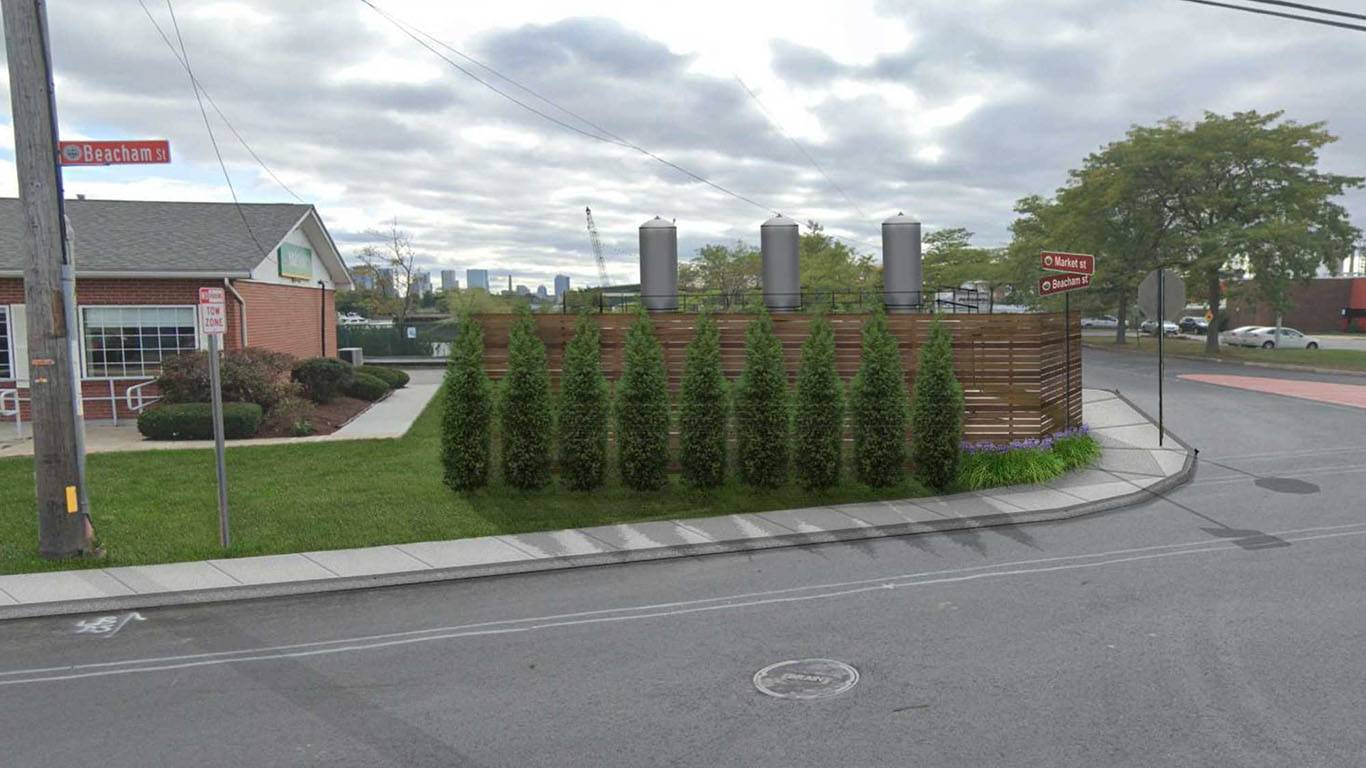
IER OUTFALL-Storm Surge Control Facility
Construct structure at the outlets of the Market and Beacham Street Culverts to prevent inland flood damage during extreme tide events and coastal storms.
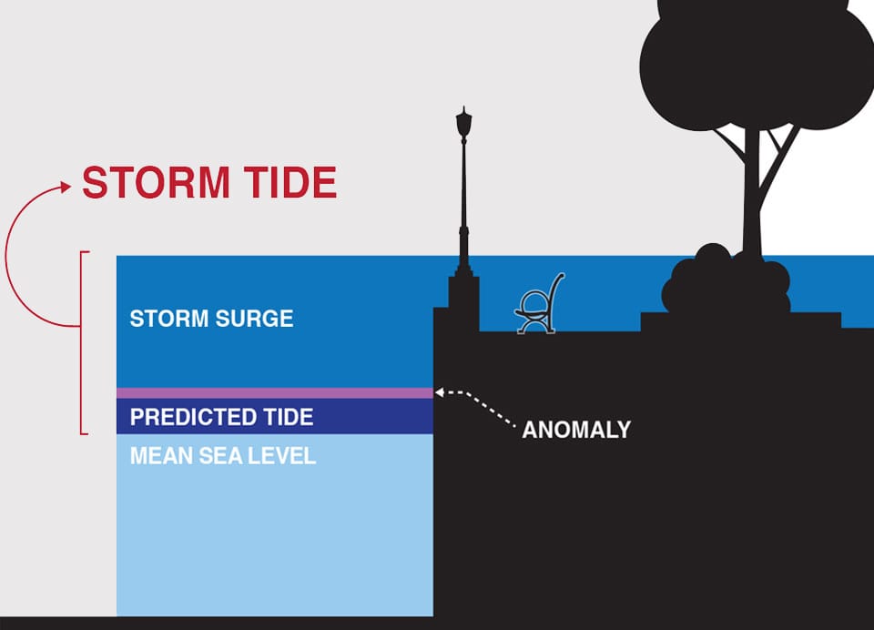
Storm surge is an abnormal rise of water generated by a storm, over and above the predicted astronomical tides. Storm surge should not be confused with storm tide, which is defined as the water level rise due to the combination of storm surge and the astronomical tide. This rise in water level can cause extreme flooding in coastal areas particularly when storm surge coincides with normal high tide, resulting in storm tides reaching up to 20 feet or more in some cases.
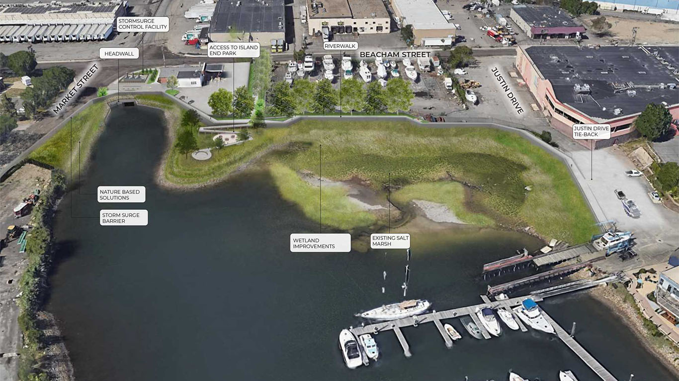
CHELSEA-Nature-based Approaches
Improve the salt marsh and riverfront slopes by removing invasive species, installing tiered cobble beach nourishment underpinned by coir logs, and planting integrated coastal and upland vegetation to provide shoreline protection and ecological enhancements along IER.
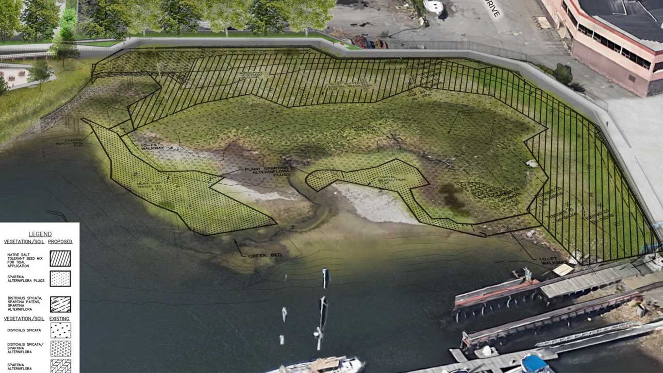
Wetlands Enhancements
The proposed wetlands enhancements will expand the existing Chelsea salt marsh into degraded areas devoid of vegetation, and other areas where trash and detritus have accumulated and where Phragmites and other invasive species have crowded out native salt marsh grasses, resulting in loss of salt marsh coverage. These areas will be cleared and replanted with suitable salt tolerant native wetland species.
The scope will seek to replicate approximately 2,745 sf of salt marsh to offset approximately 1,864 square feet of impacted wetlands resulting from removal of existing wooden boardwalk and construction of the Project, for an overall net increase of the resource area.
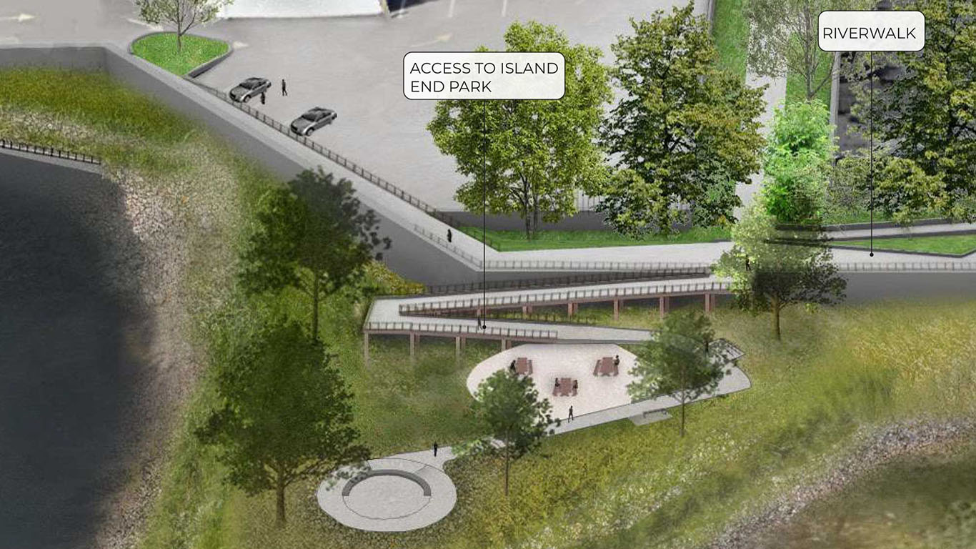
Island End Park Improvements
The existing Island End Park is a mix of urban wild and manicured greenspace and provides the community with limited waterfront access. The Island End River Park will be revitalized as a climate resilient space with a climate-adaptable, coastal planting palette coordinated with adjacent nature based approaches to shoreline stabilization and resilience. The design responds to community feedback indicating a desire for a contemporary space with pathways for active recreation, like jogging and walking, as well as plenty of space to sit and take in the views of the water. The new park design elevates passive use park space above 2070 tidal cycles, eliminates the low-elevation, wood gazebo that was structurally vulnerable to storm surge and future tides, and provides new durable seating to withstand potential inundation. A planting palette that includes shade trees will help combat the local urban heat island effect.
Documents and Plans
IERFRP Press Kit
Areas of Projected Flooding
IER MEPA Filing - Expanded Environmental Notification Form (EENF)
IER MEPA Filing - Draft Environmental Impact Report (DEIR)
IER Project Program - English
IER Project Program - Arabic
IER Project Program - Chinese
IER Project Program - Haitian
IER Project Program - Portuguese
IER Project Program - Spanish
Benefit Cost Analysis